Playing catch up with the blog, here’s what we’ve been up to in October. This month marks the end of the winter, and an earlier than usual beginning of the summer season, and a lot of things happened!
The month of the penguins
We had a number of trips to our closest neighbours, the Emperor Penguins. Everyone got at least a couple of opportunities to go an see them!
The first time I went to Windy Bay this side of winter was to retrieve a Skidoo which broke down a couple of days earlier. We went out with Rich, and seeing as we were practically there, we’ve decided to go near the edge of the ice shelf and have a sneaky peek down to see the penguins from above. It turns out they could hear us, and they seemed to be very interested in us, as quite a few of them came towards the edge of the ice shelf, directly underneath where we were.
The one disappointing thing though was that there was no penguin chicks this time, unfortunately. I’m not sure what’s the reason for it, but I was sorry not to see them.
I went out again to see the penguins, and this time to actually abseil down to the sea ice two days after we recovered the skidoo. We spent most of the day there, and it was simply amazing! The penguins were more inquisitive than I have ever seen them before. When I moved they would run away, but as soon as I stood in one place, knelt down or sat down, they would come over and watch me from a very close distance (like less than one meter away!). They also have a tendency to stand all around you, so in no time you’re completely surrounded!
I then had another chance to go and see them during my winter trip, and again a week or so later. I could literally sit there with them for days!

The GPS track above, overlaid on the Landsat 8 satellite image, shows how far out we went on the sea ice to see some groups of the penguins further out. The abseil off the Ice Shelf is in the bottom left corner of the track triangle. Below is the same GPX track overlaid on an interactive map.
Winter Trip, round two
We’ve also been running the second round of Winter Trips, and I went out as the last team. Due to the weather all trips had to be a little bit shorter, and we all had to improvise a little bit, but over all it was great! I went out with Mat our Field Guide, as well as with Ross and Greig for the first half of the trip. The last couple of days Ross and Greig stayed on base and Rich went out with us.
We spent the first couple of days in the Caboose in Windy Bay. We abseiled down to the penguins again and spent the whole afternoon there.
On day two the weather didn’t play ball at all – there was no contrast and a little bit of wind, so we couldn’t really travel over unfamiliar ground (we were planning to go towards the Rumples following the coast line), so we decided to just stay in, catch up on sleep and reading and just enjoy a little down time.
On day three we decided to come back to base, to wait the weather out there, and try for the Rumples or the N9 crevasse from there. We suffered an issue with a throttle cable in one of the skidoos, so had to leave it behind and return to base. Myself and Mat went back out to Windy Bay to recover the skidoo that afternoon and came back home again later. In the evening the weather cleared a bit, so we went to a crevasse that opened up last summer near the flag line to N9 relief site. Mat found a safe way from where we parked the skidoos to the edge of the crevasse and we explored a little inside. It was a really impressive place to be – we were walking over a collapsed snow bridge and have seen, through some cracks, that the crevasse is quite deep (I estimate another 25-30 m at least).
Greig and Ross decided to stay on base for the remainder of the break, and Rich took their place for the final two days. We went out towards the Rumples and explored the area a bit. The Rumples is where the floating ice shelf is grounded on some rocks, causing it to slow down significantly compared to other parts. The area is covered with cracks and crevasses, as well as blocks of ice pushed up and piled on top of each other. When you go there, you can hear the ice cracking (in some areas as often as every 5-10 seconds!), or some snow and bits of ice falling somewhere inside a cavity underneath and you can feel the vibrations through your feet. Unnerving, but fantastic feeling!

The GPS track above, overlaid on the Landsat 8 satellite image of the Brunt Ice shelf, shows where we went on the second winter trip. Visible are both my first and my second winter trip tracks (yellow is the March trip, blue is October). Below is the same trip (less a couple of day excursions to the rumples area) displayed on an interactive map.
Arrival of the aircraft
We also had the first aircraft arrive, officially ending the winter season. The first planes to fly in to Halley were Canadian Basler and Twin Otter from Kenn Borek. This was their positioning flight, where they travel all the way from Canada to Antarctica, to the base which they operate from – Russian Novolazarevskaya. The two crews stayed with us for a few days, waiting for the weather to improve at Novo.
A week or so after the Canadians left we had the first BAS Twin Otter arrive, bringing with it the first summer staff. We were no longer thirteen, and the summer has officially started!
Recreation on base
As the days are getting longer now, and the weather is generally improving, there was an increase in outdoor recreational activities on base as well. We did a bit of sledging (where a person is towed on a Siglen sledge behind the Skidoo), and I’ve also started my kite skiing season.
I also got an opportunity to play a little driving the Pisten Bully, which was great!
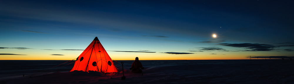
October Gallery
Enjoy my best images from October below!


Fajne zdjęcia …. wygląda na to że się nieźle bawiliście 🙂
BRAWO 🙂 (Y)